


Davis County (South)--Bountiful, Farmington & North Salt Lake Cities PUMA, Utah
About
Outline
--Bountiful%2c+Farmington+%26+North+Salt+Lake+Cities+PUMA%2c+Utah_A280.png)
Summary
| Unique Area Identifier | 194247 |
| Name | Davis County (South)--Bountiful, Farmington & North Salt Lake Cities PUMA |
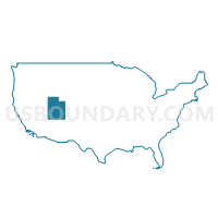
| State | Utah |
| Area (square miles) | 133.28 |
| Land Area (square miles) | 113.61 |
| Water Area (square miles) | 19.67 |
| % of Land Area | 85.24 |
| % of Water Area | 14.76 |
| Latitude of the Internal Point | 40.92304200 |
| Longtitude of the Internal Point | -111.88271190 |
Maps
--Bountiful%2c+Farmington+%26+North+Salt+Lake+Cities+PUMA in Utah.png)
Graphs
Select a template below for downloading or customizing gragh for Davis County (South)--Bountiful, Farmington & North Salt Lake Cities PUMA, Utah
--Bountiful%2c+Farmington+%26+North+Salt+Lake+Cities+PUMA%2c+Utah_T0.png)
--Bountiful%2c+Farmington+%26+North+Salt+Lake+Cities+PUMA%2c+Utah_T1.png)
--Bountiful%2c+Farmington+%26+North+Salt+Lake+Cities+PUMA%2c+Utah_T2.png)
--Bountiful%2c+Farmington+%26+North+Salt+Lake+Cities+PUMA%2c+Utah_T3.png)
--Bountiful%2c+Farmington+%26+North+Salt+Lake+Cities+PUMA%2c+Utah_T4.png)
--Bountiful%2c+Farmington+%26+North+Salt+Lake+Cities+PUMA%2c+Utah_T5.png)
--Bountiful%2c+Farmington+%26+North+Salt+Lake+Cities+PUMA%2c+Utah_T6.png)
--Bountiful%2c+Farmington+%26+North+Salt+Lake+Cities+PUMA%2c+Utah_T7.png)
--Bountiful%2c+Farmington+%26+North+Salt+Lake+Cities+PUMA%2c+Utah.png)
Neighbors
Neighoring Public Use Microdata Area (by Name) Neighboring Public Use Microdata Area on the Map
- Cache, Summit, Morgan & Rich Counties PUMA, UT
- Davis County (North)--Layton, Clearfield, Kaysville, Syracuse & Clinton Cities PUMA, UT
- Salt Lake County (Northeast)--Salt Lake City (East) PUMA, UT
- Salt Lake County (Northwest)--Salt Lake City (West), West Valley City (West) & Magna PUMA, UT
Top 10 Neighboring County (by Population) Neighboring County on the Map
Top 10 Neighboring County Subdivision (by Population) Neighboring County Subdivision on the Map
- Salt Lake City CCD, Salt Lake County, UT (932,320)
- North Davis CCD, Davis County, UT (197,425)
- South Davis CCD, Davis County, UT (109,054)
- Magna CCD, Salt Lake County, UT (28,712)
- Emigration CCD, Salt Lake County, UT (8,908)
- Morgan South CCD, Morgan County, UT (1,427)
Top 10 Neighboring Place (by Population) Neighboring Place on the Map
- Salt Lake City city, UT (186,440)
- Bountiful city, UT (42,552)
- Kaysville city, UT (27,300)
- Farmington city, UT (18,275)
- North Salt Lake city, UT (16,322)
- Centerville city, UT (15,335)
- Woods Cross city, UT (9,761)
- West Bountiful city, UT (5,265)
- Fruit Heights city, UT (4,987)
Top 10 Neighboring Unified School District (by Population) Neighboring Unified School District on the Map
- Granite School District, UT (385,194)
- Davis School District, UT (306,479)
- Salt Lake City School District, UT (186,440)
- Morgan School District, UT (9,469)
Top 10 Neighboring State Legislative District Lower Chamber (by Population) Neighboring State Legislative District Lower Chamber on the Map
- State House District 13, UT (50,040)
- State House District 15, UT (48,703)
- State House District 18, UT (39,762)
- State House District 20, UT (38,155)
- State House District 53, UT (37,757)
- State House District 25, UT (34,235)
- State House District 24, UT (32,363)
- State House District 23, UT (31,676)
- State House District 17, UT (31,571)
- State House District 19, UT (29,561)
Top 10 Neighboring State Legislative District Upper Chamber (by Population) Neighboring State Legislative District Upper Chamber on the Map
- State Senate District 21, UT (112,079)
- State Senate District 19, UT (91,855)
- State Senate District 22, UT (89,061)
- State Senate District 23, UT (87,939)
- State Senate District 1, UT (87,412)
- State Senate District 2, UT (82,957)
- State Senate District 7, UT (79,585)
Top 10 Neighboring 111th Congressional District (by Population) Neighboring 111th Congressional District on the Map
Top 10 Neighboring Census Tract (by Population) Neighboring Census Tract on the Map
- Census Tract 1254.03, Davis County, UT (11,439)
- Census Tract 1261.04, Davis County, UT (10,758)
- Census Tract 1262.02, Davis County, UT (8,580)
- Census Tract 1270.04, Davis County, UT (7,756)
- Census Tract 1271, Davis County, UT (6,957)
- Census Tract 1263.06, Davis County, UT (6,883)
- Census Tract 1261.05, Davis County, UT (6,834)
- Census Tract 1270.02, Davis County, UT (6,738)
- Census Tract 1269.02, Davis County, UT (6,318)
- Census Tract 1265, Davis County, UT (6,128)
Top 10 Neighboring 5-Digit ZIP Code Tabulation Area (by Population) Neighboring 5-Digit ZIP Code Tabulation Area on the Map
- 84010, UT (44,821)
- 84037, UT (33,369)
- 84116, UT (33,297)
- 84108, UT (20,738)
- 84025, UT (18,255)
- 84054, UT (16,196)
- 84014, UT (15,268)
- 84087, UT (13,983)
- 84050, UT (9,290)